TapTheMap

Mac app for real estate drone photos

Label your drone photos in minutes.

TapTheMap reads the flight data inside your DJI drone photos and places the property pin, nearby places with distances, and lot lines on every photo for you. Adjust anything, then export.

Free to download. Try every feature free for 3 days. Requires macOS 15 or later.

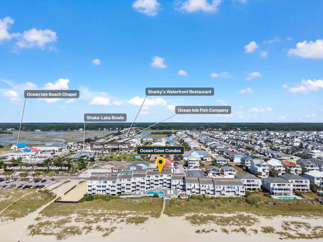
Aerial photo of beachfront condos with a gold property pin labeled Ocean Cove Condos and flags for nearby restaurants, a chapel and a park.
Real exportStraight out of TapTheMap on a real job. No hand labeling.

How it works

Five steps from flight to finished photos.

TapTheMap was built to take the slow part out of every job. Here is the whole workflow.

  1. Drop in the flight

    Drag a flight's photos, or a whole folder, onto TapTheMap.

  2. Type the address

    Enter the property address once for the batch.

  3. Pins land for you

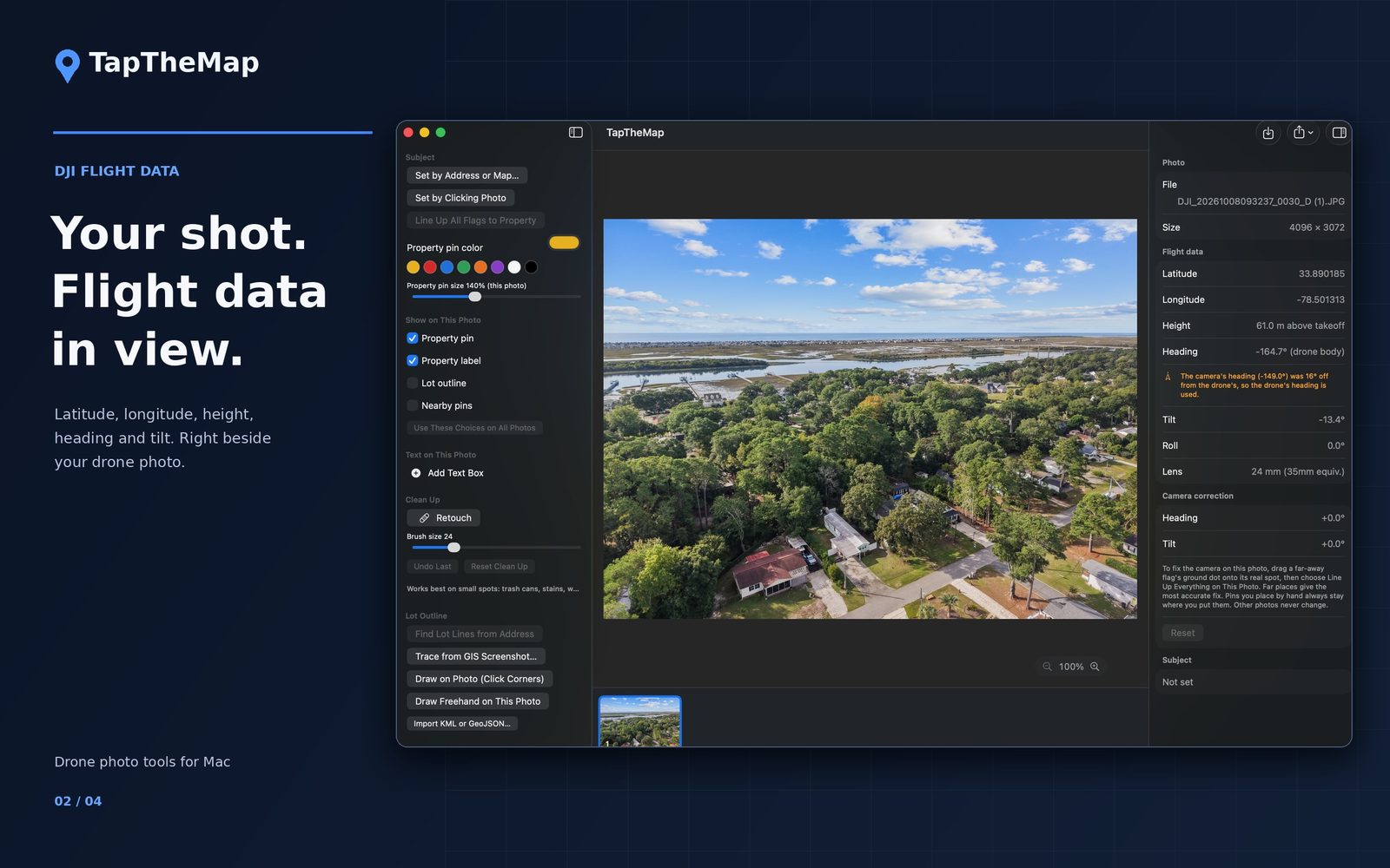
    GPS, height, heading and camera tilt put the pin and nearby places where the camera saw them.

  4. Adjust anything

    Drag, rename or hide any pin or flag on any photo.

  5. Export

    Save finished JPEGs to a folder or straight into a Photos album.

Real results

Real exports from real jobs.

Nothing here is a mockup. These photos came out of TapTheMap exactly as shown.

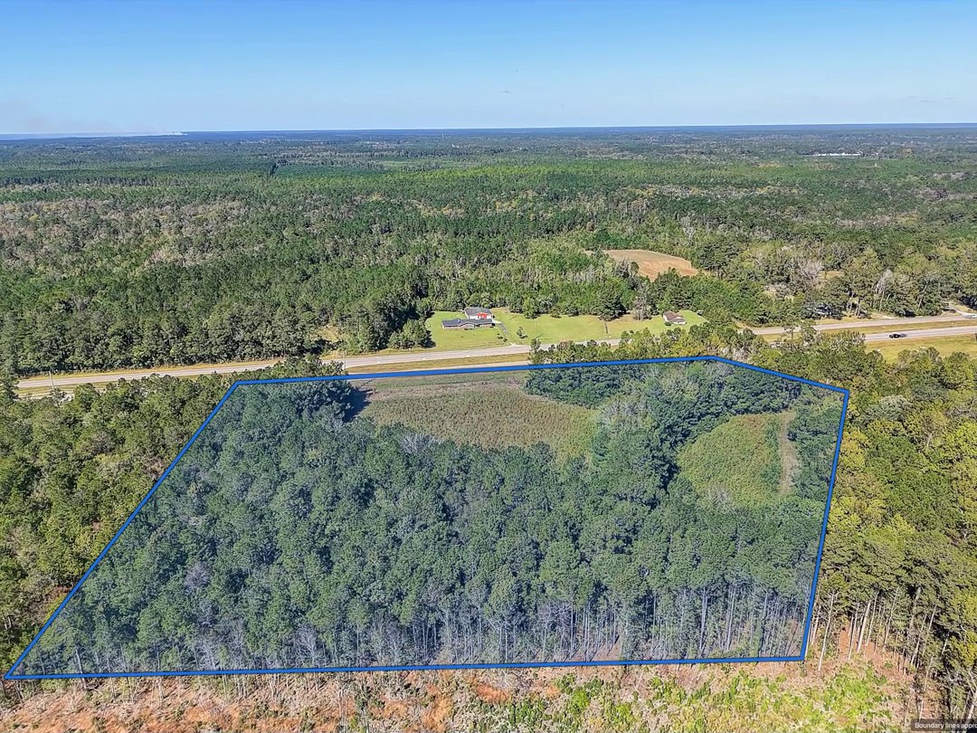
Aerial photo of a wooded lot beside a highway, outlined in blue, with a small Boundary lines approximate notice.
Real exportLot lines on a wooded lot, with the optional "Boundary lines approximate" notice.

Inside the app

Made for the way you already work.

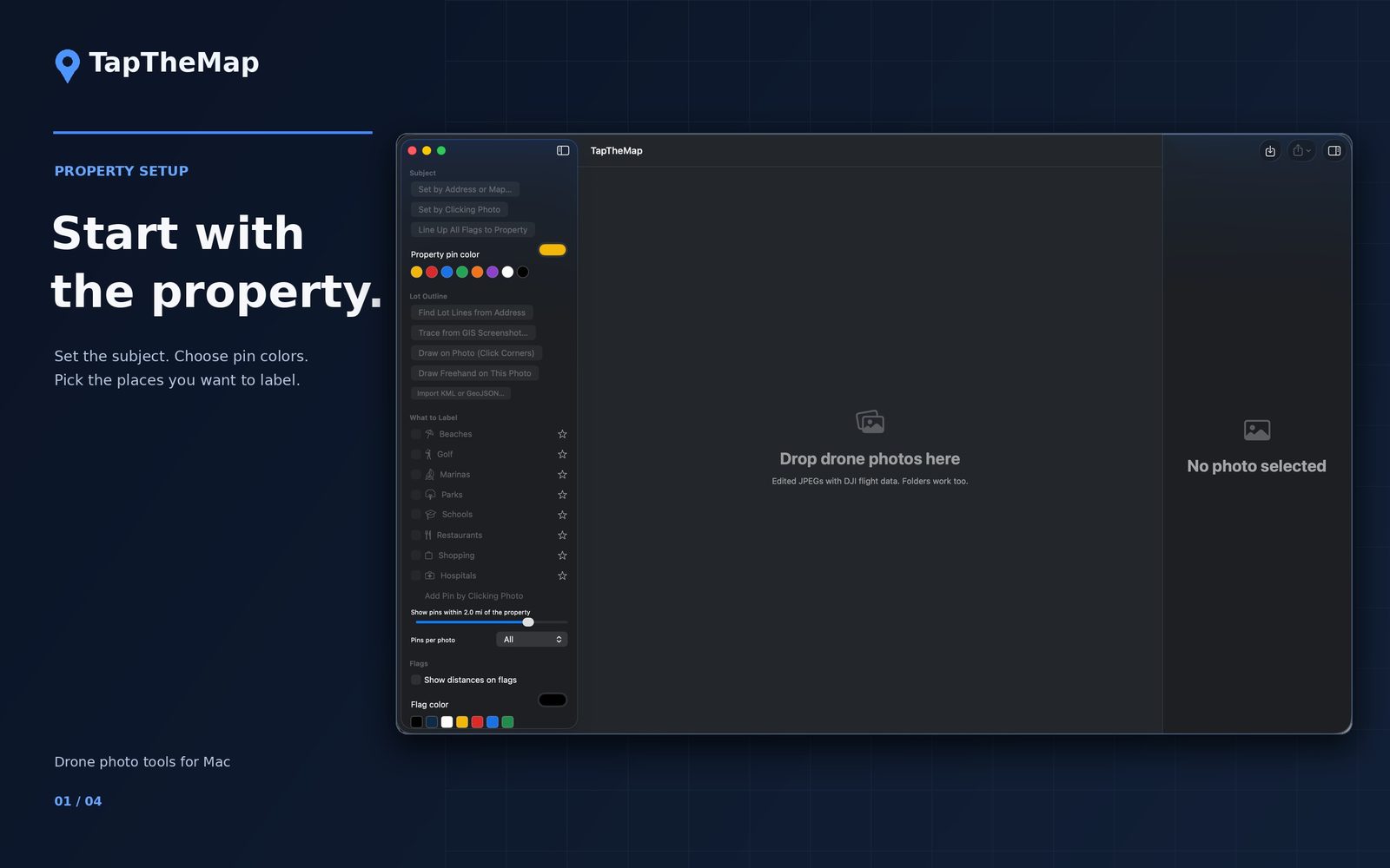
One window. Your photos in the middle, the controls on the left, the flight data on the right.

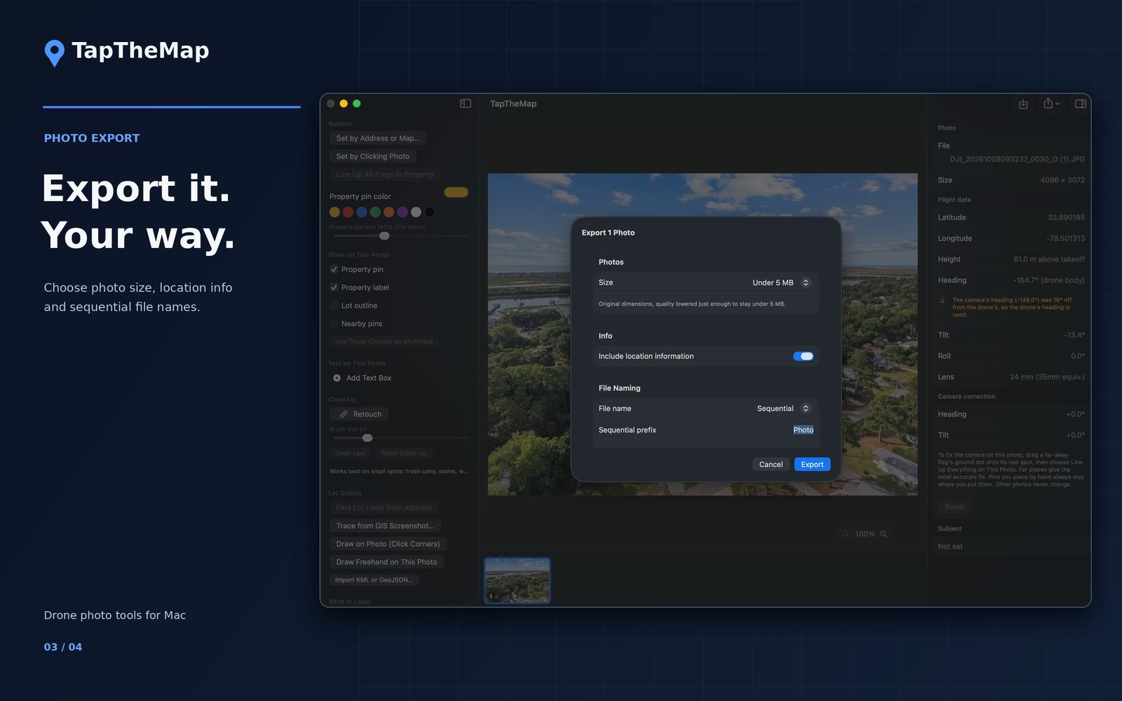
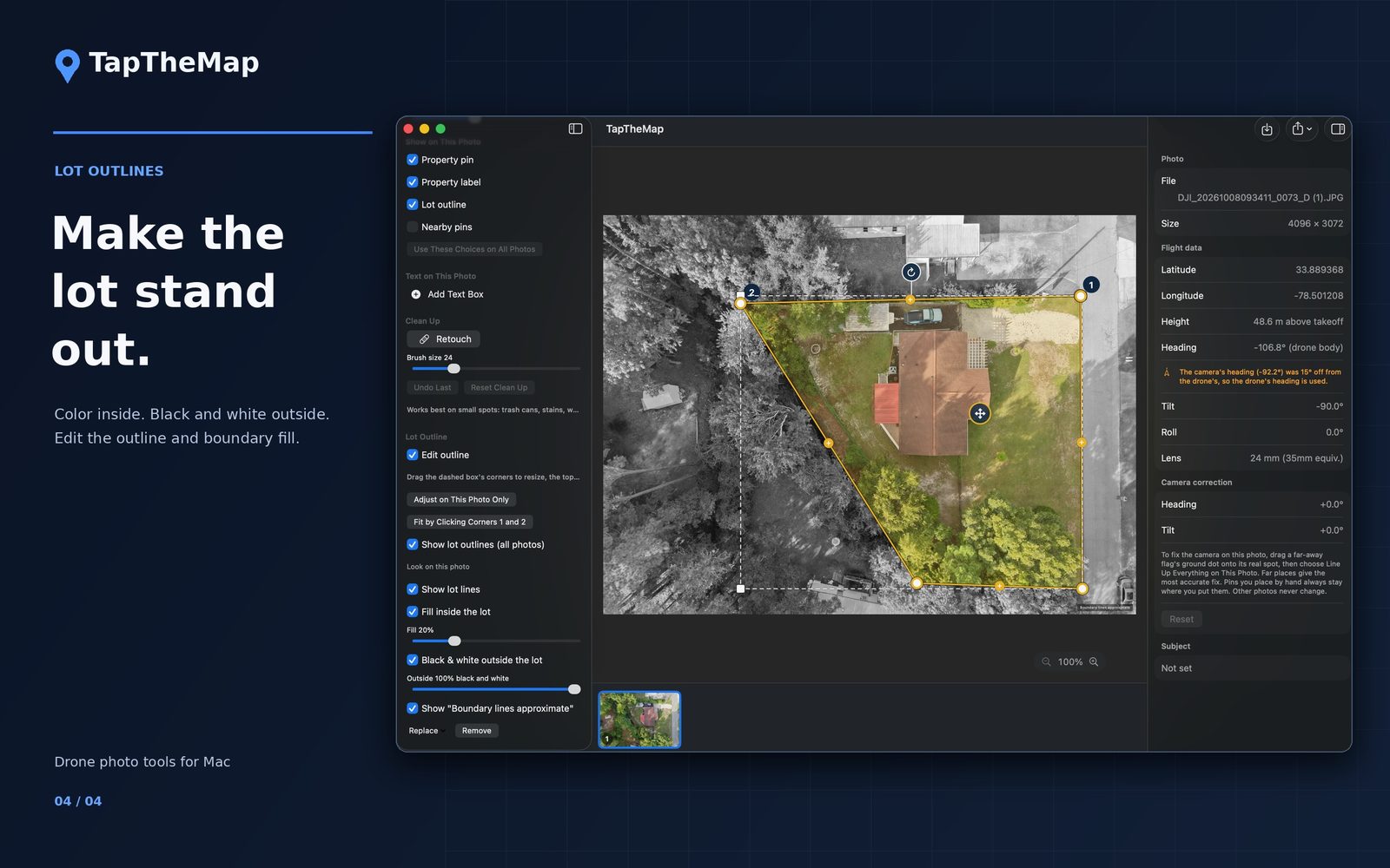
TapTheMap window ready for photos, with property setup, lot outline tools and place categories in the sidebar. A drone photo open in TapTheMap with its latitude, longitude, height, heading and tilt shown beside it. The export sheet with size, location information and sequential file naming options. A top-down photo with the lot outlined in color and everything outside the lot in black and white.

Features · Version 1.0.2

Everything it does.

Automatic labeling

  • Property pin with an address label on every photo that shows the house
  • Nearby places with distances: beaches, golf, marinas, parks, schools, churches, restaurants, grocery stores, shopping and hospitals
  • Star a category and its nearest place always shows when it's in the photo
  • Flags land on the part of a beach, golf course, park or marina the photo actually shows
  • Limit flags to the nearest few and set a maximum distance

Find a Landmark New

  • Search any landmark by name, like a lighthouse, a bridge or a pier, and pin it
  • Put it on this photo and later ones, only this photo, or every photo
  • Or drag a search result straight onto the photo
  • Saved under My Landmarks for future shoots in the same area

Lot lines

  • Find Lot Lines from the address using your county's GIS link, added once in Settings
  • Or trace a GIS screenshot, click the corners, or draw freehand
  • Fill the lot with color and turn everything outside it black and white
  • Optional "Boundary lines approximate" notice on the photo

Every photo stands alone

  • Drag, rename, resize, recolor or hide any pin or flag on one photo without changing the others
  • Double-click a flag to type its name
  • Text boxes with optional backgrounds
  • Clean Up brush paints away small distractions like trash cans and wires. Your original file is never changed.
  • Cmd+Z undoes any change

Accuracy and cleanup

  • Fix Alignment: drag one far landmark onto its real spot and the whole photo corrects
  • Level from Horizon for shots over water
  • Drone / Camera compass switch when a photo's two compass readings disagree
  • Never Show This Place: right-click a wrong result and future searches skip it New
  • Settings > Blocked Places lists them, with Unblock

Files and export

  • Opens JPEG, HEIC, TIFF and DNG raw photos New
  • Exports JPEG at Full Size, Under 5 MB for most MLS limits, or Web (2560 px, under 2 MB)
  • Files named in order, saved to a folder or a Photos album
  • Works with Dropbox and Google Drive folders through Finder
  • Save a batch and reopen it later
  • Mouse wheel zoom and Space-drag to move around New

Good to know

What it doesn't do (yet).

Read this before you buy, so there are no surprises.

  • Automatic placement reads DJI flight data.Photos from other drones (Autel, Skydio, Parrot) and phones import fine, but you place the pins by clicking.
  • Mac only for now.There is no iPhone or iPad version.
  • Pins are as accurate as the drone's compass.Far places can sit a little off until you use Fix Alignment.
  • Some search results will be wrong.Places come from Apple Maps and OpenStreetMap. Never Show This Place removes a wrong one for good.
  • Find Lot Lines needs county GIS data online.Not every county publishes it. Tracing a screenshot or drawing always works.

Pricing

Try it free. Pay once or yearly.

Free trial

$0 for 3 days

  • Every feature, no watermark
  • Starts when you choose Start Free Trial
  • Costs nothing and doesn't renew

One-time unlock

$79.99 once

  • Every feature, no watermark
  • Every photo exports at once
  • Yours to keep

Yearly

$29.99 per year

  • Every feature, no watermark
  • 3 days free first
  • Renews yearly. Cancel anytime in your Apple Account.

US prices. The Mac App Store shows prices for your country. Without the trial or a purchase, everything still works, but exports carry a small TapTheMap watermark and export 5 photos at a time. Purchases restore on any Mac signed in to the same Apple Account.

Privacy

Your photos never leave your Mac.

TapTheMap processes every photo on your Mac. Only searches go out: addresses and landmark names to Apple Maps, map locations to OpenStreetMap, and the property location to the county GIS link you added.

Read the privacy policy

  • Photos are never uploaded
  • No account or login
  • No analytics, ads or tracking
  • Purchases handled by Apple

Try it on your next shoot.

No drone handy? Open the app and choose Help > Open Sample Job to try it on a sample photo.